I've been reading way too many Appalachian Trail books lately! Not that it's a bad thing. A Walk in the Woods by Bill Bryson and Where's the Next Shelter by Gary Sizer really capture my imagination and are two personal favorites.
A big hike outside of the Adirondacks had been something I wanted to do for a little while now... Just to get a different view of things. Kailee would be spending Mother's Day at her Mom's house. So, I began brainstorming for an "epic" adventure.
Thanks in large part to Sizer's detailed account... It took me about three minutes to settle on Moosilauke (4802'), the 10th highest peak in New Hampshire. It was one of those back of the brain "some day" hikes that quickly moved to the front of the brain.
Upon making this well thought out three minute decision, I was determined on one thing: Hike the stretch of Appalachian Trail out & back to the Gentle Giant's Summit. Immediately, I began putting the plan in motion and spent the next five days preparing for the trip. I obtained maps, some extra gear & researching Moosilauke.
After work on Saturday, I ran home & threw my backpacks in the car and hit the road to New Hampshire at 10PM. It was a three hour drive down winding roads in pure darkness. I made a quick rest stop at a pulloff and the stars put on a brilliant show.
 |
| The first white AT Blaze that I spotted in the pitch dark. |
I arrived at North-South Road in Warren, NH at 1AM. After parking the car I grabbed my bag with my camping gear (which is more suited for music festivals than adventures such as this), strapped on my headlamp and walked 2/10th of mile into the ominous woods to the Jeffers Brook Shelter. No one else was there. Rather than set up my tent in the dark, I opted to sleep in the shelter.
I set up my cot & sleeping bag and made a small fire in the fire ring to scare off any potential bears... They say there's more of them than people in this area!
 |
| My home for the night. |
I awoke at 8AM on Sunday morning to birdsong. My surroundings were no longer ominous. Rather, I was encompassed by beautiful woods and a charming stream illuminated by a bright bluebird sky. I used the privy and carried my camping gear back to the car and exchanged it for my hiking pack and set off for the Glencliff Trailhead.
 |
| Not even close... Just a small view of the massif. |
From this vantage point I could only see the Southwestern part of Moosilauke. The Summit was hidden from my view.
After signing in at the trail register, I started my hike in earnest. I passed a meadow (which I learned is where many AT hikers camp) and began my ascent.
"You've made it this far in pretty good time. But, if you keep up this pace, you'll collapse before getting to the top," I thought.
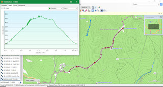
After this little break, I slowed my pace and took shorter steps. I also broke the hike down into sections by using waypoints that I had previously plugged into my GPS. This change in approach was great. I felt much better and made decent progress.
The Glencliff trail is very attractive. Much of the mountain is owned by Dartmouth College. The numerous trails are maintained by the school's Outing Club, lending to it's nickname: Dartmouth's Mountain.
 |
| Yeah... I drank that water! |
I passed a number of runoff streams and shimmering pools. At one of the small pools, I tried out my new Sawyer water filter... Nothing better than drinking from the source!
It was so cool to pass the white AT blazes on the trees and rocks.
"Yes! This is where some of my favorite authors stood and stepped!"
Around 3700', I encountered ice. Out came the microspikes. I had no issues proceeding forward.
The ice and snow continued up to the point where the AT/Glencliff trail merges with the old Carriage Road. I continued towards the Summit. The trees grew shorter and shorter.
I was able to get my first real views over them to the Southeast of New Hampshire and views of Vermont from the Southwest to the Northwest.
 |
| The goal. |
Around this point, Moosilauke's Summit came into view. It looked much further away than it actually was... Only a half mile. As the tree line came to an end, so did the snow and ice.
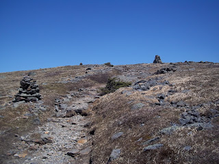
From here on out, it was only alpine vegetation, rock & massive cairns leading the way.
Upon reaching the Summit sign, the Presidential Range immediately jumped into sight. My jaw hit the ground.
 |
| YES! |
Driving down winding roads in the pitch dark. Sleeping in a shelter. Waking up and walking into the woods. Unable to see the summit-goal for the day. Not being afforded any sort of clean views outward from the trail until late in the hike...
After all of that... I was rewarded with a brilliant blue panorama of the White Mountains.
 |
| The White Mountains! |
I spun around a few times and enjoyed a completely unobstructed 360° view!
The Presidential Range isis mind-blowing!
There were a lot of people hanging around the Summit. I hunkered down in a vacant "wind shelter" made out of rocks and enjoyed a quick lunch before walking around for a little bit.
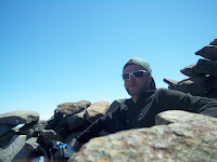
From my spot on the rock couch, I texted my Mom a picture holding a "Happy Mother's Day" sign.
I saw a guy with a big pack heading out and asked him "How far are you going?"
"Not far," he replied, "This is just a day hike to practice for a traverse of the Canadian Rockies!"
After he departed, I had the Summit to myself... For about two minutes.
Another hiker approached and we had a nice conversation. He was doing a practice run for the Pemi-Loop, which he pointed out to me. That's a mega hike!
"I'm glad that I did this," he said, "I had too much stuff in my pack and my water bladder burst two times on the way up! Now I know what to do!"
We chatted a while and I told him "I think I need to make a visit to the White's more often."
I spent well over 90 minutes at the Summit before heading out.
On my way back, I tagged South Peak (a smaller peak on the massif) for good measure. It gave me a wonderful view of what I had accomplished for the day.
 |
| South Peak. |
The descent back to the trailhead was nice and sweet. I had hoped for an "epic" adventure... And, I totally got one!
One doesn't have to walk from Georgia to Maine to enjoy the Appalachian Trail.
The trail is there for everyone! Day hikers, section hikers and thru-hikers alike! Get out and enjoy it!
Differences that I noticed between trails in the Adirondacks & the AT/Glencliff Trail on Moosilauke:
-I spotted no erratics (common everywhere in the ADK) on Moosilauke.
-I could tell that the rocks on Moosilauke were pushed upwards from continental collision and eroded away rather than glacial deposits uplifted by a hotspot in the Adirondacks.
-Granite! This type of rock is common in the North Country... But, not as common -or shiny- as the ones that I saw at Moosilauke.


No comments:
Post a Comment