Saturday, August 26, 2017

Big Crow and Little Crow Mountains


At the Summit of Big Crow.

August 22, 2017 was the date of the Great American Eclipse.
It was also the date that Kailee and I bagged two mountains in a second consecutive day for the first time.

 The eclipse had peaked and it really had no effect on the North Country. So we set off for Keene, NY to learn the trails at Big Crow and Little Crow Mountains. The Crows are in the Hurricane Mountain Range and we had to drive up a long dirt road to get to the trailhead.

There's a number of mountains and loops that one can take from the trailhead but we only had enough time to tackle the Crows.

First up was Big Crow... It's a really easy mountain to Summit at .7 of a mile. It took us about 20 minutes to climb it's steep trail to get there. Kailee wanted to lead us up the hill and I approved. She did a great job!
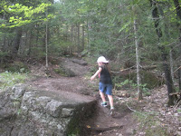
Kailee leading us up Big Crow.
The Summit of Big Crow offers delightful views of Jay, Hurricane and many other tall mountains.
It looked like you could almost reach out and touch them.

It was a pretty hot day, but it was nice and breezy on top of Big Crow, which was appreciated by both Kailee and I.
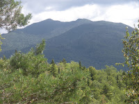
Hurricane Mountain from Big Crow.

After taking some time to relax and enjoy the view, we climbed down the other side of the mountain to a col decorated with oaks, maples, and birches before climbing up Little Crow. This added a little over a half mile to our trek and it was well worth it.

Little Crow has some really nice views and it was cool to look back at Big Crow and see how much taller it is and how much we had traveled.

We spent a bit of time checking out things on the trails of Little Crow before making our return trip to Big Crow. Once we climbed it again, we took a brief break before descending to our car.
Big Crow with Jay in the background from
Little Crow.


On the way down, Kailee declared:

"I want to climb all of the mountains in New York State."

A pretty bold statement for a seven year old. But, with seven mountains under her belt this year... I'd say she's off to a good start.

On top of Little Crow.

The Crow's trailhead is located at the end 
of O'Toole Road off Hurricane Road in Keene.
The Nun-da-ga-o loop and Hurricane Mountain can also be reached from the same parking lot.

Wednesday, August 23, 2017

Silver Lake Mountain


Kailee and I rolled up to Silver Lake Mountain in the evening after having a nice walk up Clark Mountain on August 20.

There was only one car in the parking lot at that hour, but I could tell by the trail book and online reviews that it was a popular hill.

The trail starts out kinda steep but it has a number of points of relief. Quite a bit of the trail is on cleared boulder and the rest is dirt, roots, and stones.

Silver Lake Mountain is a quick trail (Only 2 miles out and back). But, it's definitely worth checking out. Kailee requested taking a break 2 or 3 times at points where there were ledges or views. So, the timing of breaks coincidentally worked out nicely.

The mountain offers some nice views and has some neat fungi.

Maybe it was because we made our ascent as it turned to evening and no one else was on the Summit... But, Silver Lake Mountain had a real serene feeling and the color of the sky was awesome.


Aside from Silver Lake, the mountain offers views of Taylor Pond, the Adirondacks, and of course Whiteface... I'm also pretty sure that I spotted the recently completed Clark Mountain...

Our descent to the car was really quick and Kailee ran the last leg of the trail to the parking lot.
Is that tiny Clark Mountain hiding
behind that little mountain in the forefront?


This ended up being our second time that we hiked a pair of mountains in a day. And, the match-up of Clark and Silver Lake Mountain ended up being a pretty nice combo.


Silver Lake Mountain trailhead is on Silver Lake Mountain Road in Black Brook.


Hey Guys!


Tuesday, August 22, 2017

Clark Mountain

Kailee & I at the Summit of Clark.

I've really been enjoying hiking the past few years and this year has been the most active of the bunch. It's helped that Kailee is older now (7) and can handle some mountain trails.

I downloaded the All Trails app a few weeks ago and it has been really helpful in so many ways. One "local" climb that the app has suggested is Clark Mountain.
A water tank near at the trailhead.


I could tell from it's stats on the app that it might be a really easy climb. So, Kailee and I set out to climb Clark and if we had enough time possibly climb Silver Lake Mountain afterwards on August 20.

Clark is located off a dirt road next to two giant water tanks in Jay. It borders some private property, but everything is well marked and it's easy to stay on track. The mountain is a little steep to start off, but nothing serious. You follow the red markers to the top and there is a split providing a Summit loop along the way. We took the left trail on our ascent.

It's a very easy walk to reach Clark's 1,066' Summit... We got there in 16 minutes.What Clark lacks in height & gains, it makes up for it with it's great views of Beaver Pond, a swamp,
We see you Whiteface!
 some High Peaks & Whiteface. It makes up for it even more with it's trail which is beautifully maintained. I'm not joking, the trail is pretty immaculate. I'm not sure if it's a privately owned mountain that's open to the public or if a neighborhood association takes care of it... But the trail is in beautiful condition and dotted with acorns.

The top of Clark looks like it may have suffered from a fire in the past. The oaks & pines there are all 20' max in height. There is plenty of cleaned Earth to relax on and take in the views.

Kailee and I really liked Clark and we took the loop for our descent.

Clark is a great mountain for families and picnics. It would also make a great mountain for a kid's first ascent and Summit.

Like I said, it's not challenging... But, everything about Clark Mountain is pretty beautiful.


Clark Mountain is located at the end of Summit Drive in Jay, NY.


Monday, August 21, 2017

Shingletree Pond Trail

Shingletree Pond.
Shingletree Pond trail is a two mile out and back trail that begins at Courtney Pond on Route 9 in North Hudson.

Kailee & I first tried this fun little hike last year and had another go at it on August 15. It's about a thousand feet away from Sharp Bridge Campground.

Courtney Pond itself is a lovely little body of water & it's worth checking it out a little before you do the trail. If you are into water snakes, then walk along the grass between Route 9
Courtney Pond.
Water Snake!
and the pond and there's a good chance you'll see one. I've seen a water snake there that's over three feet long on numerous occasions & during our most recent visit I saw three of them.

Anyhow, the Shingletree trailhead is just to the right of the Courtney Pond parking lot. You cross a few foot bridges over some swampy terrain. Then you come to the trail register. It's a low key trail... Our registry from last year was on the previous page to this year's entry.


You then work your way around half of Courtney Pond through the woods. The trail is next to the
Rock blown away when they built the Northway.
 Northway and the noise of traffic can be heard. Also, you'll see rocks with holes through them as a result of being blown up and falling to their current resting spot as a result of the Northway's construction.

Soon, you come to a runoff stream and a private well. Follow the runoff to the fence and climb up the trail to... The Northway underpass!!!

The underpass is cool in more ways than one! It's an egg shaped tunnel about a hundred feet below the highway and on a hot Summer day it's 10-20 degrees cooler than the outside air.


Underpass!
You may want to bring a flashlight to proceed. But, we've done fine without one in our two Shingletree treks.

Once you pop out, you're at the secluded Shingletree Pond in the Dix wilderness. This trail can be used as an access point to bushwhacking the mountains in the area. Obviously, we weren't there to do that, so we relaxed & took some pictures before heading back.


Shingletree Pond.
As a note: the Shingletree pond trail borders private land. Pay close attention to the trail on the way back... Last year Kailee & I ended up lost for about 20 minutes in a ravine before working our way back to the trail.

Shingletree Pond trail is pretty fun. It has some nice scenery and the underpass is really fun!
Give it a shot if you're ever in the area!


Friday, August 18, 2017

Clap Mountain

Kailee and I love to go camping at Sharp Bridge Campground in North Hudson each Summer.
It's an old, sleepy campground on the bank of the little Schroon River. I can't believe that I haven't done a review on Sharp Bridge yet! And, I promise that I will... Soon... It might be a long blog... We like the place!

Anyhow, there's a bunch of trails within an earshot of the campground and some in the campground itself. The main trail is the 5.2 mile Trout Pond-Ensign Pond Road Trail which has a number of destinations that one can hit up. We tried hiking to the East Mill Flow earlier in the Summer but our trek was cut short thanks to a downed tree taking out foot bridge #4. (We did make it to the East Mill Flow last year).

When we returned to Sharp Bridge on August 14, we planned to hike the Sharp Bridge cliffs instead of trying the main trail again.

Looking up at the Sharp Bridge Cliffs.
To get to the cliffs, you sign in at the main trailhead and walk a short distance over a foot bridge and then the trail splits. Take the left trail to get to the cliffs. It's an unmarked trail, but you can't miss it and it's only about a quarter mile to the top of the cliffs. We've actually seen people climbing the cliffs with ropes and belays in the past. But, you can get to the top of them by veering left and then climbing to the right up a steep pine needle covered hill.

The Sharp Bridge Cliffs are a part of Clap Mountain and they have some cute rock edifices which make it a great place to have lunch and gaze out over the the river valley cutting through the mountains to the Southeast. There's a lot of beautiful fauna on the
cliffs and I have run into garter snakes up there on numerous occasions. There is a smaller ledge on the backside of the cliffs that looks out towards the Dix range.

A Garter Snake friend!

The rocks at the top of the cliffs.
A great place to have lunch or relax!


From the main ledge at the cliffs, one can turn left and see the Summit of Clap Mountain and more ledges. Looking at the Summit, Kailee and I decided to try and get there.

There is no trail from the Sharp Bridge Cliffs to the Summit of Clap Mountain. We were aware of this from our previous adventures... So we had to bushwhack it. Which wasn't that bad. It was maybe another 600-800 meters to the Summit.

View of the Little Schroon Valley
from the top of Sharp Bridge Cliffs.
The ground was mostly covered with birch leaves and we walked on them doing our best to not disrupt the wildlife. In certain areas you descend before arriving to the final climb which is not difficult for an able-bodied adult or kid. After a short ascent, you reach the tree covered peak.

Clap Mountain offers limited views to the East and West. There's a thin ledge facing the West but I wasn't going to bring Kailee down to it. Aside from the fun little peeks outward, we saw a number of cool things on top of the mountain including rocks, mushrooms, and an incredible root system of a downed tree.

Our path to the Summit of Clap.
At 1,610' above sea level, Clap Mountain isn't very remarkable by any measure. It's basically a big hill that happens to have some pretty cool ledges and views of the Adirondacks. Because of this, there is very little information available on the internet about Clap... (Go ahead & Google it... I'll be here waiting...).


Looking West from the Summit area of Clap.


It took us a minute or five to find some familiar landmarks before we bushwhacked our way back down to the cliffs and eventually the campground.

Kailee and I weren't trying to set any records by climbing Clap. We just did it for the fun of it. And, she seemed to really enjoy the whole experience of it. That being said, in our personal record books - it put Kailee at 3 Summits for the year and me at 7.
Kailee descending Clap Mountain.


As I stated, Clap Mountain isn't remarkable in it's level of incline or difficulty. But, it wasn't a worthless climb for us either. It was something fun to try... And now, there might be one more Google entry out there when someone happens to type in Clap Mountain!

Clap Mountain is located off the trailhead in Sharp Bridge Campground in North Hudson
on Route 9.


Really cool roots of a downed tree near Clap Mt Summit.


Berkeley Green - 6er Bell

After hiking Baker & Haystack Mountains on August 8 with my daughter Kailee, I had completed the Saranac Lake 6er Challenge. So, we had one more stop to make before driving home.

We pulled up to Berkeley Green in Downtown Saranac Lake. It's a cute little park with a stage. On the stage is a Sixer register book where I entered my name and summits. Then in 6er tradition, I turned around and rang the 6er bell while Kailee took some pictures.

A man passing by shouted out "Congratulations!"
I yelled back "Thanks!"


It was a fun little moment that I'm glad Kailee was there for.

One.
The 6er challenge was a lot of fun. When I started it, I was in the worst shape of my life thanks to diverticulitis and some other health issues that I dealt with this year. Two weeks later, when I finished the challenge I was back into alright shape. My legs felt great & I wish I had a scale to document my weight loss.


I would like to extend some thank you's.

Two.
-Thank you Noelle for letting me tag along for the Ampersand hike! It's such an awesome mountain and I had an equally awesome time with you and Beth and Emmie! My body needed this climb! Never-ending thanks!  

-
Thank you everyone who asked me if I was trying to be a 6er after the Ampersand Hike. It really got the idea in my head and put the motivation in place to do it.


Three.
-Thank you Sean for tagging with me for St. Regis & Scarface mountains on back-to-back days. It was great catching up and sharing a bunch of laughs! #PartyTube!


Four.
 -Thanks Ryen for accepting my last minute offer to climb the beast that is McKenzie! It was my third mountain (and biggest) in as many days! I felt such a high level of accomplishment after we KO'd that sucker! Boom. Bam!


Five.


 -Of course, Thank you Kailee for being an all around amazing kid and for helping me finish up the 6er challenge by doing Baker & Haystack with me in one day. I'm always proud of you! You really kicked some butt on the hills & that was so cool!


Six!


Saturday, August 12, 2017

Haystack


I had absolutely no plans of completing the Saranac Lake 6ers by hiking Haystack when I woke up on August 8. The plan was to climb Baker with my daughter Kailee.


Sometimes, plans change...

We completed Baker in the morning and decided that we were going to try for two mountains in one day. We would take a shot at Haystack.

We arrived at the Haystack trailhead on Route 86 in Lake Placid around 1PM. Kailee quickly noticed that the sign also said McKenzie on it. She had asked me about all of the Sixer's earlier in the day and taken particular interest in both Scarface (intriguing name) & McKenzie (The Big Girl).

"Why does the sign say McKenzie?" she asked.

"Because, you can take this trail to both McKenzie and Haystack," I replied, "We're only doing Haystack."

And with that, we signed the register and hit the trail.

One word can sum up Haystack's trail this Summer:

Mud.


Mud.

It was everywhere. The trail itself wasn't too difficult for me and there were certainly a few spots that were tricky for Kailee... But, the amount of mud was outta control!


Aside from the mud, the trail provides peaceful and pleasant scenery. Crystal clear runoff with little waterfalls line most of the first 2/3rd's of the trail and it's a treat for both the eyes and ears.


I also noticed some different types of colorful fungi and interesting fauna that I hadn't seen on the previous five Saranac Lake 6ers trails.
There were a number of bright orange ice cream cone-shaped mushrooms with water collected inside their "cup" and I thought they were really freaking cool.

We passed the remains of an old cabin which still had an old bucket and some pipes on display.
Cabin Remains.
Supposedly, the trail to McKenzie breaks somewhere near here... But, I didn't notice it and was somewhat surprised by that... It didn't matter either... We continued following the blue markers towards Haystack.

We soon came to a dam where you have to navigate over a handful of rocks. The water is moving quick and there's a lot of it this year. I held out downed branches to act as a railing for Kailee to use both times we crossed the dam.

The trail continues on a very gentle incline until you near the Summit. At that point the incline picks up and I had to do a little climbing and Kailee had to do quite a bit of climbing due to her size. We took it easy and she did a great job on the rocks. Right after that, we hit a ledge which offered a charming view of Saranac Lake.
DAMMMMM...


After taking some pictures, we continued on the trail and hit the peak shortly thereafter. It took us about 2.5 hours to get there and we were awarded with striking views of Lake Placid and the High Peaks on a beautiful afternoon. Kailee initiated a game of "I Spy with my little eye," which is actually a really great game to play on a cleared Summit. We spotted birds, lakes, boats among other things during the game.
Ledge overlooking Saranac Lake.


After hanging out and checking some of the side trails we began our descent. Kailee once again did a great job of handling all of Haystack's obstacles.

 There were times where Kailee would stop to check something out and I'd end up a hundred feet in front of her and then wait for her to catch up. On our way down we didn't try as hard to avoid the mud so she was covered from head to toe when we reached the car.

At the Peak of Haystack. 6 out of 6.


With two Saranac Lake 6er's down in one day Kailee was off to a great start to someday completing the challenge on her own. For me, hiking both Baker & Haystack in one day meant my Sixer challenge was unexpectedly completed. And, I was ecstatic that Kailee was with me for that.

Kailee switched out of her muddy shoes and we hopped in the car and drove to Berkeley Green in Saranac Lake...
Haystack Mountain is Located on Rt 86 in Lake Placid.

Back at the car... Caked in mud.

Friday, August 11, 2017

Baker


I enjoyed climbing four of the Saranac Lake 6ers while my daughter Kailee was vacationing in Maine. During that time, I decided that I would do Baker Mountain (or Mount Baker as the locals call it) with her since it is the smallest of the bunch.

We drove to Saranac Lake on August 8. It was one day after her seventh birthday and I figured the hike would be a nice way to continue the celebration.

Baker's trailhead is right in town next to the lovely Moody Pond. I could tell by the number of cars in the lot that it was a popular hike. The trail register confirmed that... There was no spaces left in the book to sign in. So, I crammed our names and the date in on the top edge of one of the pages. We spoke to an older couple at the register for a minute and then began our way up the hill.

There's two paths that you can take to the Summit of Baker. The marked trail leads to the right and an unmarked trail heads left. I had read online that the left trail is easier & since this was the first full mountain Kailee was attempting we took that route.

My simple summary of the left trail is... Don't take the left trail.

The Bug Zone.
It was by far the buggiest trail I had been on all Summer. A constant swarm of mosquitoes followed us up the hill despite being doused in bug spray. Additionally, the left trail is rather unremarkable aside from some ledges near the Summit. Those ledges can be reached from the Summit anyways... So, I suggest taking the marked trail and checking them out after you reach the peak.


The peak of Baker is very nice and it only took a mere thirty minutes over 0.9 of a mile for us to get there. One can take in views of McKenzie, Haystack,
Village of Saranac Lake viewed from Baker.
Scarface, Ampersand, the High Peaks, lakes and the village of Saranac Lake from Baker's ledges.

About twenty minutes after we arrived there we bumped into the couple we saw at the register.

"Oh, you finally made it up here," said the man.

"What are you talking about? We've been up here for 20 minutes," I replied with a hint of sarcasm.

We chit-chatted with them for a few minutes before they decided to make their descent.
At the Summit of Mount Baker.


Kailee & I then enjoyed lunch on a ledge overlooking the village. It was still pretty early in the day. The weather was nice and we began discussing what we should do for the rest of the afternoon.

Then, out of the blue, I had an idea. I asked Kailee if she would want to try hiking Haystack. She thought it was a good idea. So, now we had a newly improvised plan in place.

We finished our lunch and took a few pictures before descending on the marked trail. It was much nicer than the first trail and I regretted not taking it up... But, what can ya do? Live and learn.
McKenzie viewed from Baker.
We passed a lot of people as we made our way to the trail register.

Mount Baker is by far the easiest of the 6ers. Kailee had zero problems with it. It is a family friendly hike and it's a good starter mountain.

We got in the car. Five of the Sixers down for me. One down for Kailee.

That was about to change... Very soon.

Mount Baker is located next to Moody Pond on Forest Hill Ave in the Village of Saranac Lake.