Thursday, August 16, 2018

Algonquin, Boundary, Iroquois & Wright 8-13-2018


Iroquois Peak!


"Yup. That's the McIntyre's right there. We're gonna go there next week," Kailee said while pointing at the imposing mountain range from Indian Falls last week.

She told other hikers during our trek of Tabletop that "We're gonna climb Algonquin next week."

I'm not exactly sure how she decided that the McIntyre Range would be our next hiking destination... But, it seemed like a plan to me!


McIntyre Range from Indian Falls
on 8-6-18.

Monday's forecast called for a chance of showers around 11 AM and possible storms in the evening.

The Macs are notorious for being one of the windiest places in the 'Dacks. The big goal was to tag Algonquin, Iroquois & Wright... There was also the realization that we could walk away with only one -or- none: if the elements decided to act up.

It was slightly overcast as we drove down Adirondack Loj Road. From the car, it was apparent that Algonquin's head was in the clouds. Otherwise, the skies didn't look too threatening.

We pulled into the Loj at 7:30AM and popped in the High Peaks Information Center to use the bathrooms and poke around for a few minutes before returning to the car to gear up.


 Indian Pipe.

At the register, we met a Mother and her son (he appeared to be a year or two year younger than Kailee). One quick look at her hat & pack and it was obvious that she was a Winter 46er. She told us that her son picked Algonquin as their destination for the day... I guess this was "Kids Choose the Hike" Day.

"She (Kailee) says you're going for all three today," the Mother said.

"That's the goal... But, we'll see," I replied.

The woman knew there was a chance of early rain and evening storms as well.

We walked with them for a short while before they fell behind.

The approach took us through the forest and over a bridge lined with raspberries along a beautifully maintained trail owned by the Adirondack Club before crossing over to State land. Almost immediately, the trail went from gentle to climb-time.


Getting steep!

Algonquin is the 2nd highest point in New York State. Big Al reminds you of that fact every step of the way. It's all about ele-ele-ele-vation gain!

Despite the nonstop rise, Algonquin's trail didn't have any difficult scrambles or big obstacles. (Later in the day, Kailee stated "Algonquin was easy,").

Taking quick breaks every few minutes due to the heavy gain kept our energy up!

A good portion of the trail is stone stairs. These stairs and many of other rocks that we stepped on were covered in a thin layer of slippery dirt. Fortunately, this never caused a problem. But, it was something to be aware of while moving along.


Near 3300', we arrived at McIntyre Falls. I'm sure it's an impressive sight in Spring and early Summer. But, on this day it was merely a trickle. Looking outward from the falls offered no view thanks to the clouds.


McIntyre Falls.

A few minutes later, I looked up and spotted signs of blue sky! Things were looking up -and- going up! I decided that we should go for Algonquin first.

A large group of college kids were hanging out at the Wright-Algonquin trail spilt . We said "Hello" as we passed. We took the righthand route and pushed onwards to Big Al.

The trail led us up some steep open rock pitches (which may be small slides). It was nothing complicated. We've faced much trickier situations this Summer.


A long stretch of open rock.


The trees were getting shorter. The sky was showing more signs of blue. We were about to bust out of the tree-line!

A sign warned us that we were entering the Alpine Zone: time to do the rock hop.


Entering the Alpine Zone.


Large cairns led us towards the summit. Turning around afforded impressive views of Wallface, Street and Lake Placid.

Beatiful small purple flowers and bunchberries lined the path. The sun was shining overhead. This was it!


Kailee led us on the final charge and as we reached the top -BAM- an absolutely incredible view of the High Peaks and most notable: the trap dike and many impressive slides on Mount Colden. The slides reflected different colors brightly.

Hands down one of the most gorgeous sights that I've witnessed in the Adirondacks.


Colden & it's gorgeous slides (foreground) from
Algonquin.

Walking towards the benchmark, we were greeted by the summit steward at 12:30 PM.

"Hi, I'm Mike" he said.

"We're Facebook friends," I replied.

"Justin?" he asked.

"Yup, that's me," I answered.

Mike is an active member of the 46ers and is my friend Jim's correspondent. A few months back,  Jim suggested that I send Mike a friend request in case I ever want to get some hiker info.

It was very cool to put a face to a name at 5114' above sea-level!


Myself and Mike!
With a photobomber!


I originally planned to only spend a few minutes at the summit before going to Iroquois, backtracking and enjoying Algonquin some more before setting off for Wright Peak.

So much for the plan!!! We spent an hour relaxing, enjoying the 360° vista, chatting with other hikers and Mike.


Algonquin!

Mike offered to watch our bags so we could slackpack to Iroquois. Awesome!

Just as we were preparing to go... The Mother and her young son that we met earlier arrived at the summit.

"This is his fourth High Peak," she said excitedly.

"Congratulations! Good Job!" we replied.

"Did you guys get all three?" she asked Kailee and I.

"No," I laughed, "On our way to number two now!"

We followed the exposed rock down the  western slope of Algonquin towards Iroquois. It was a quick and easy (albeit steep) drop down the rock. Kailee and I ducked into the trees on a narrow path.


Great Range.

Between the two High Peaks, we climbed Boundary. A 4800' peak that lacks the prominence & isolation to be considered a High Peak. Boundary itself is very cool. It's above tree-line and offers a similar view as Algonquin but has the distinction of offering the bonus view of Big Al and Iroquois!

Throughout the afternoon, large ravens hovered over the mountains and shrieked. A few flew right by us as we walked.

Algonquin from Boundary.

We had a recurring joke as we proceeded. Anytime that either of us would say "Right," the other would respond:

"No. Wright's over there," and point in the general direction of Wright Peak.

Passing the cairns, we dropped down back onto another path through stunted pines with puncheons over some boggy terrain. The climb of Iroquois was pretty easy and had one optional scramble near the summit.


Iroquois Peak.

We had Iroquois (the 8th tallest High Peak in NY) to ourselves. It was really nice. Colden's slides continued to put on a stellar performance. In the opposite direction was a close-up view of Wallface's craggy mean-mug.


Wallface from Iroquois.

Just below the summit, I spotted Sheperd's Tooth. It's a cool rock outcrop that one may receive a badge for visiting. We mulled over going down to the Tooth. It was right there and I was quite sure that I spotted it's herd path. Ultimately, because of the time of day and not wanting to add extra elevation gain/loss to our trek... I decided to leave a visit to the Tooth for another day.


Sheperd's Tooth.

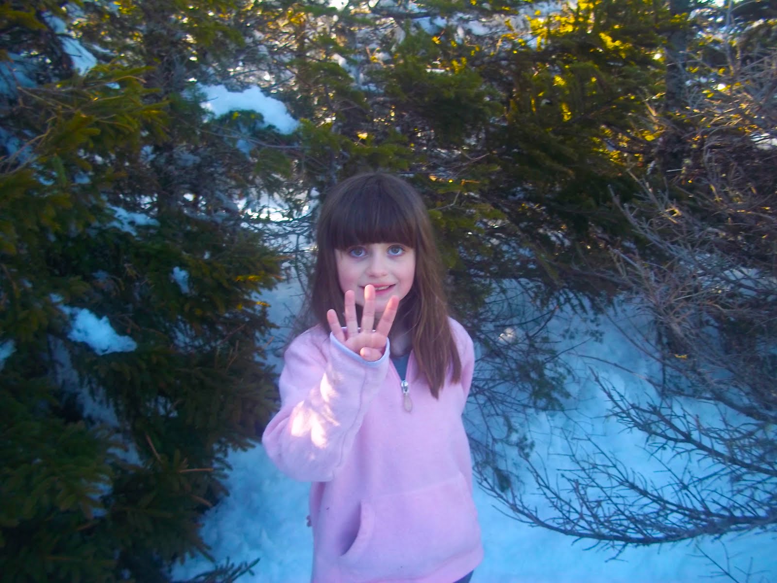
Kailee later said that Iroquois was her favorite peak of the day. I get it... It has a wonderful vista and it was nice to be the only people there!


Great Range, Marcy & Colden from Iroquois.


On our way back to Big Al, we decided to "race."

I reached Boundary first. But, my legs tired on the descent and Kailee took a strong lead on the re-climb of Algonquin and cleanly beat me to the finish.


Whiteface & Lake Placid from Algonquin.

We had lunch and continued chatting with Mike for quite a while.
Mike was impressed by the fact that Kailee and I have worked our way through a number of smaller & mid-size peaks and told us "You're doing it the right way."

We didn't make a "Wright is over there," joke.

"You're doing it the right way," he said, "I got so caught up with the 46 and am just learning that I overlooked so many great places!"

There are so many amazing peaks in the park! Go out and see them!

It was time to descend and give Wright Peak a try. So, we said our farewells with Mike.


Trail Split!


Arriving back at the trail junction, we had only 4/10th of a mile to go to the summit of Wright. I ditched my pack near the junction and carried Kailee's pack up. Again, it was another steep climb. There was one scramble near the top that neither of us had a problem with. Soon, we were at the top.

Kailee charging up Wright Peak.

Kailee found a pile of rocks in front of a "Rock Drop" sign.

"Yeah, I forgot to bring one up," I said.

"I didn't," Kailee replied.

"You brought a rock up?" I asked.

"Yup," she said as she pulled a stone from her pocket and tossed it onto the pile.

Maybe that's why we lucked out with the weather!


Algonquin and it's slides from
Wright.


Wright (16th tallest High Peak in NY) would make a nice hike on it's own. But, we both agreed that it was the lesser peak of the day. Although, it offered an excellent view of  Lake Placid, the Great Range and some slides on Algonquin.

Wright Peak.

A few other hikers arrived shortly after and took our pictures for us.

After our photo-op, we left the summit to find a short side trail that led us to some interesting pieces of history.


View towards Whiteface from Wright.
Sign indicating the summit to the right
and the plaque to the left.

In January 1962, a B-47 Bomber running a low altitude practice mission from Watertown to Plattsburgh was obliterated when it slammed into Wright Peak at high velocity.

The plane's four man crew were killed and it took months to find their remains. One of the airmen was never found...


 Landing Gear.

 Remains of the B-47 Bomber.


A large piece of landing gear and some other chunks of the plane lay on the ground with a nearby plaque honoring the troops. Small metal pieces of the aircraft are scattered among the rocks and gravel underfoot. We collected a few small pieces off the ground.


Memorial Plaque.

It was getting late in the afternoon and was time to head back to the Loj. We began our descent.

We stopped at McIntyre Falls to refill our water. There was a group of campers there & we chatted with them briefly before continuing our way down.

We arrived back at the trailhead before 8PM... Just  in time for sundown. A wonderful three peak day (four including Boundary).  This adventure put us at a total of 18 High Peaks!

Back at the car, we changed out of our sweaty clothes. Kailee put on her bathing suit and took a quick dip in Heart Lake.

Afterwards, we popped by the Loj and helped ourselves to some refreshments: a coffee for me and a water for Kailee.

This was a spectacular day of elevation change, views, history and fun!


One Final Observation Regarding Algonquin:

Algonquin reminds me of a much bigger version of Cascade.... Both mountains involve steep climbs, long stone stairways, & limited views until the final push. They have large open summits that offer wide open 360° vistas... They also have a sorta similar view from (obviously) different angles. To the one side is Lake Placid, the Olympic venues and the surrounding communities. On the other is a wonderful view of the High Peaks! 


Kailee on Iroquois.
Her "favorite" peak of the day.


Hike Stats:

12.4 Miles
11:50 total time including over 3 hours of Summit time (not including other breaks).
Total Ascent: 4764'.
Total Elevation Change: 9420'.


Wednesday, August 8, 2018

Tabletop 8-6-2018


"Is there a table on Tabletop?"

Kailee pondered this question for a number of months... It was time to find the answer on what would be Kailee's Birthday hike! (Her birthday was the following day).

Looking at the stats from our Phelps hike, I figured that we could probably sleep in a little before this adventure. We've been getting up really early for our last few treks in the High Peaks. So this was a nice change.

We arrived at South Meadow, signed in at the register and hit the Marcy Truck Trail at 10AM.

The weather was great and raspberries lined the trail. We munched on handfuls of the delicious wild fruit as we walked.

I like the truck trail because it's pretty soft on the feet and one can cover the 2.8 miles to Marcy Dam pretty quick. We stopped at Pelkey Brook for a minute. The last time we were here, the brook was roaring... This time it was just a dribble.


Marcy Dam.


We arrived at Marcy Dam at 11:15 AM and took a 20 minute break. We chatted with a Dad and his two boys from Syracuse for a bit. They were headed to Phelps... So was everyone else as it seemed. The trail registers were loaded with groups of people heading to that destination. I was glad that we were heading to a place that was in "less demand."

I felt like we really dawdled after resuming our hike on the Van Hoevenberg trail. Our pace wasn't excruciatingly slow but it just seemed like we were taking it extremely easy... Not a bad thing!

At the turnoff for Phelps, a sign reminded me that we would be heading towards Indian Falls as well as Tabletop. I had noticed that the waterfall was only a little further past the turnoff for Tabletop while researching our hike and totally forgotten about it until this moment.

Sticking to the right!

I suggested to Kailee that Indian Falls might be a worthwhile visit before climbing Tabletop and assured her that the side-jaunt would only be a difference of a few hundred feet. She agreed.

At this point, the Van Hoevenberg trail led us up the shoulder of TR mountain. It wasn't a strenuous stretch by any means. We ran into a number of people including a chatty Canadian woman who was "crazy" about her "trekking poles!"


Phelps from the Van Hoevenberg trail
on the shoulder of TR Mountain.


We arrived at the junction for Tabletop at 1:35 PM. A resting hiker told Kailee that she was "the youngest kid that I've seen all day!"

A number of people asked Kailee "How old are you?" throughout the afternoon.

"Seven," Kailee would reply, "But, I turn Eight tomorrow!"

Which would be met with a chorus of "Happy Birthday!"

Ten minutes past the Tabletop junction, we arrived at Indian Falls! The waterfall was down to a trickle. But, the vista from atop the falls was spectacular! An amazing view of the MacIntyre's!

The Macs from atop Indian Falls!
Enjoying a snack at Indian Falls!


We rested and had a snack while absorbing the scenery before heading back to the Tabletop trail.

Tabletop's trail is unmarked. But, it's hard to lose it. It's the long strip of mud heading upwards in a gnarly second growth forest that is ready to slice and cut you up if you step off the trail. This may be the muddiest trail that we've ever been on. Don't dress to impress if you're going to hike this mountain.


As we gained elevation a lovely breeze rolled in and cooled us down a little.

The forest gave way to stunted pines and flag trees as we neared the top. Turning around offered us another view of the MacIntyre's (which we would also enjoy on our descent later).


Field mouse.

We hit the summit at 2:54 PM and had the place to ourselves for about 45 seconds... A couple arrived just after us and another group of hikers followed them shortly after.

Tabletop is mostly tree-d in and it's overlook is very small.

Kailee looked around and confirmed there was "No table on Tabletop." Aw shucks!

While it's not the widest view out there, it did afford us the closest view of Basin, Haystack & Marcy that we've had to date. From the many angles that I've previously viewed Basin, it resembled the spikes at the end of a stegosaurus tail. It was neat looking at it "head on" from Tabletop.


Marcy.

Haystack.


We found a bench-like rock and sat down for lunch. We eat tuna sandwiches that I prepare on the spot for most our hikes. But, this time we tried something a little different: Luncheon Loaf (aka Fake Spam) sandwiches with mayo! A decent and filling change of edibles!


Luncheon Loaf!

As we finished up our lunch, all of the other hikers left. We finally had the place to ourselves. We took pictures and enjoyed the sounds of nature.

We began our descent down the muddy trail at 3:40 PM.

"If I'm gonna come back here" Kailee stated in reference to the mud, "I think I'd wanna do it in Winter."

A fair assessment.

We got our muddy feet off Tabletop at 4:25 PM and proceeded back towards Marcy Dam.

We continued to run into a lot of people on the Van Hoevenberg trail including a Jewish family consisting of a father and his three boys who had just ascended Mount Marcy in long sleeved white shirts and black dress pants. That wouldn't be my choice of apparel for a 14 mile hike on a hot day... Power to them!


A cascade of water flowing off a log near
the Van Hoevenberg trail.
This photo was taken by Kailee.


We arrived back at Marcy Dam at 6PM and took another break. It was dinner time and dozens of campers were enjoying their meals around the stream. We took everything in one last time before departing for the car.

Kailee's leg cramped up on the truck trail (first time this has happened on our hikes). She powered through the pain and drank water in hopes of it going away. She was relieved to get back to the car at 7:15 PM and be able to sit and rest her leg. She was also very happy to have completed her 15th High Peak on the eve of her birthday.


15 High Peaks down and relieved to sit in the car!
Selfie by Kailee.
The past year of Kailee moving from regular hikes to learning the trails on mountain hikes has been amazing. She constantly impresses me with her abilities and the way she absorbs hiker knowledge.  I'm very proud of her and am glad that we had a great time on her big Birthday Hike!


Birthday fun on Top of the Table!


Tabletop hike Stats:


12.5 Miles
2707' Total Elevation Gain
9:21 Total Time


Friday, August 3, 2018

Whiteface 7-30-2018


Whiteface!
Our 14th High Peak!


Kailee spent last week in Maine on vacation with my parents. One of our conversations on the phone went like this:

Me: You better go grab Katahdin while you're there!

Kailee: I was just saying that... I can get it... I need a few years but I can get it!

I'm pretty sure "I need a few years"  meant walking into Baxter State Park and hiking Katahdin solo.

Me: Well, just so you know. If the weather is good... Our next hike will be Whiteface.

Kailee (voice cracking in excitement): YESSSSSSSSSSSSSSSS!


Kailee has asked me about climbing Whiteface on a weekly basis for almost a year
. The mountain's popularity & aura (and castle) captured her imagination.

Brothers Bob and George Marshall along with their trusty guide Herb Clark were the first people to climb all 46 of the Adirondack High Peaks. The first High Peak that they climbed together was the 'Face on August 1, 1918.


Bob Marshall & Herb Clark.

For the past few months, I planned on lining up Kailee's dream hike with the 100th anniversary of the Marshall's & Clark's trek.

Preparing for this hike was pretty easy on my part. In April, we "accidentally" hiked Whiteface's sister peak Esther... On that day, we set out to climb the sub-peak Marble Mountain and scope a little bit more of the trail... If possible... The conditions ended up being so nice that we were able to bag Esther in 3' of snow!


Esther. 4-22-2018.
In a few feet of snow.

That experience helped immensely in gearing up for Whiteface.

Marble Mountain is an Adirondack "Mean Mile." 900' of elevation gain over 9/10th's of a mile. It's an unforgiving little climb. My plan was to take it slow up Marble with a short break at it's summit. Then, keep the pace easy as we worked our way up Lookout Mountain before picking up our pace on the ridge to Whiteface.

We arrived at the Atmospheric Scientific Research Center at 8 AM and were on the trail 10 minutes later.

Kailee rocked a USA Olympic shirt that I recently picked up & customized by adding the number "14" to it. A fun memento serving as a nod to Whiteface's Olympic history and representing our 14th High Peak!

We stuck to the plan. We took our time walking the old tow-rope ski path on Marble - which is appropriately named... Besides the quick elevation gain over this "mean mile," stepping over-and-on a million loose rocks rocks is like stepping on a bunch of marbles!


Old Ski Patrol shed on Lookout.


I feel that our slow and steady approach to this stretch of the trail was perfectly executed. We arrived at Marble's summit at 9AM. We took a quick break and took in the view. After a snack, we began the trek up Lookout Mountain.

Lookout is much more forgiving than Marble. There's not many views on this stretch of this trail but the going is pretty easy. 


We passed the time by discussing some High Peaks that we could try next year... And, by making goofy jokes.

We arrived at Lookout Mountain's ski trails at 10:57 AM. We took a nice snack break at the ski lift. From this point, we had a nice view outwards. Although, the immediate view of the ski area was kinda ugly in my opinion... I'm sure it's nicer in ski season. Garbage left by skiers in Winter is unappealing in the Summer.


A view towards the Great Range
from the ski trail on Lookout.

The ski lift area offered a nice view of our target.

Whiteface was in reach.

We resumed our venture...


It's right there!


After a few hundred feet back on the trail and I realized something was missing... Trekking poles... I jogged back to the ski lift and retrieved them while Kailee sat & waited next to my backpack.

With all of my gear in tow, we were ready to proceed.

Without saying a word, Kailee led the charge.

She jumped into a mode that I've never seen out of her.
This was the first time that I had to work to keep up with "Pokey Moonshine."
(I dubbed her with this trail name a few weeks back).

"I can climb that! I know how to climb that!" Kailee shouted when we hit the large retaining wall separating the Whiteface Highway from the hiking trail.

"We're not doing that," I replied.

The hiking trail parallels the road for a stretch that I've deemed "Dynamite Alley."


Kailee leading the charge above the
highway.

This stretch requires stepping on rock that clearly sits in it's current placement as a result of the explosions that created the highway.

After some jagged rock maneuvering, we hit an intersection with the Highway.

"Do you wanna take the road or the trail?" I asked.

"The trail," Kailee replied.

Good call Kailee!


Pokey Moonshine leading the charge!

This was the most fun part of the trail. The trees grew shorter as we continued along the open rock pathway. Views were offered in every direction... Including our goal.

Kailee went into "next level mode." She ripped through this incredibly fun stretch of trail much faster than I.


One of Whiteface's impressive slides.


No, I wasn't slacking on purpose... She had purpose and determination in her eyes and on the mind.


At 12:20 PM, we arrived at the summit sign stating "4867 Ft Above Sea Level - Whiteface."


We made it!

Kailee celebrated by doing a summit back-bend!


Summit back-bend!


We were greeted with astonishing views and by a mob scene of tourists. This place was a zoo! I knew there was a very strong chance that there would be a lot of people there and tried to wrap my head around that before arriving... Nevertheless, it was still very jarring.


ASRC Tower and part of the mob.


The visibility was amazing despite a faint haze to the sky. The High Peaks looked grand. However, looking at many of the smaller peaks that we've climbed over the past year was just as appealing.
A flock of ravens circled the summit and made loud shrilling caws.


Lake Placid.


We walked to the area facing the High Peaks and waved at the Research Tower's webcam so that my parents could watch us from far away on their phones.

Then we went over to the tower to check it out. The ORDA steward informed us that the elevator was being repaired but the building was still open. Inside, there was a display on how the tower "catches clouds" and analyzes the air quality.


How to capture a cloud.


There was also an old fireplace. Next to it was a picture of the Beatles. Evidently, the last time the fireplace was lit was the year that the Beatles broke up... I love me a good Beatles reference!


Old Smokey.


The Beatles "making an appearance "on Whiteface!?!?!
YES!!!


We popped out of the tower on the Northern facing side. There was no one there. I figured that it would be a good spot away from the crowds to relax and enjoy the scenery. I enjoyed a Coca-Cola and gazed at our friends Lyon, SLM, Catamount, Esther and even our little buddy Clark!


Enjoying a Coke while looking at our friends to
the North.

After a nice amount of time hanging around the summit, we went to the stairway to walk down to the castle. We both agreed that this was the worst part of our experience. It took forever to cover what should have been a quick stroll... Complete traffic jam... Tourists panicking because of fears of heights.

Very annoying.

The castle itself is pretty neat looking. I was hoping that there might be a hot dog cart or something where we could get a quick, cheap bite.


The Castle.


How naive of me. This is a tourist trap. Everything at the gift shop and cafe was outrageously priced!

So, we opted to fill our camelbacks in the sinks and grabbed a picnic table outside where I made some tuna sandwiches.

All in all, we spent 2.5 hours at the top of Whiteface. By far, the most amount of time that we've spent atop a High Peak.

There was no point in going back up the stairs to get back on the trail with all of the tourist traffic.

We walked the highway towards the junction with the trail. I spotted wild strawberries growing alongside the road and we stopped to fill up a bag of them and snack! Tart & delicious!


Wild Strawberries!

Once back on the trail, we had an enjoyable and easy descent.

"I made a little friend at the summit," Kailee said.

"Oh yeah?" I replied.

"Yeah, she said she hiked up to the top," Kailee continued, "But she and her mom didn't have any backpacks... They were tourists."

"That's alright," I assured her as we made our way through Dynamite Alley.

We got down to Marble Mountain and once again enjoyed it's view during a brief break before making it's steep descent.


A bright pink rock spotted on our descent.


With only around 100' to go before hitting flat land... I stepped on one of Marble's loose marbles and fell. I hurt my elbow and scratched up my right arm pretty good in the crash.

Finally, we arrived back at the car and exchanged a bunch of high fives. Kailee was very happy. This was her hike and she did an excellent job.

As a reward, we drove to McDonald's in Lake Placid and munched on Happy Meals while looking out the window at Whiteface. A nice way to end a big day.

Things have surely changed at Whiteface since the Marshall's & Clark first climbed it. I like to think that they would be proud of this little girl that set out to re-create their historic climb 100 years (almost) to the day. Kailee worked hard and made her dream of climbing Whiteface come true!


"Hello? Anybody there?"
(Inside the ASRC Tower at the
Summit of Whiteface).