Tuesday, February 13, 2018

Mount Baker 2-4-2018


Winter Carnival is Saranac Lake's fun wintery take on Mardi Gras. It's a week of music, events and activities that draws visitors from near and far.

The weather forecast for Sunday looked decent. So, I decided that we would put our own spin on Winter Carnival and planned a full day of exciting things to do... Beginning with a climb of Mount Baker.

Kailee and I have never climbed a mountain in Winter. I figured Baker would be a good one for our first attempt. I borrowed a pair of microspikes for me to use and bought some trekking poles for Kailee.

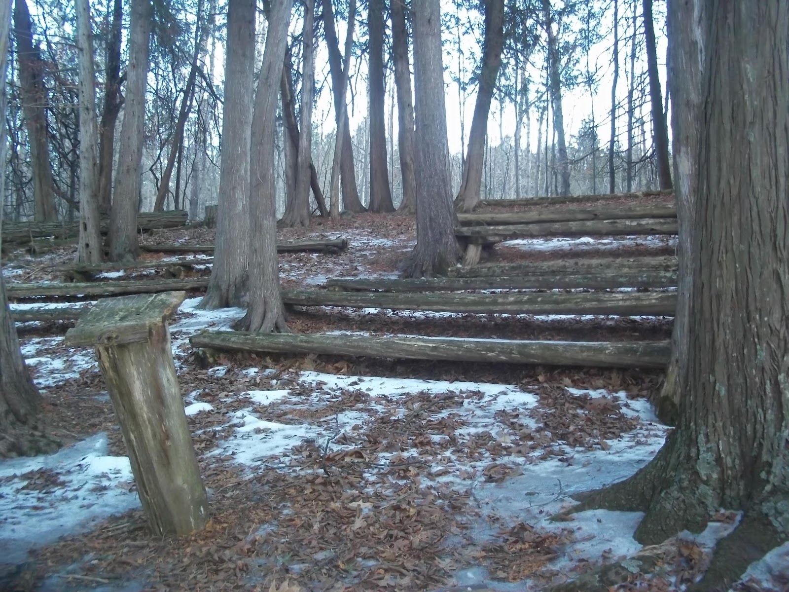
We started our hike on the frozen shore of Moody Pond at 1:30. We followed the marked trail which was caked in a thick layer of ice, thanks in large part to the mountain's popularity.


We ascended into a cloudy haze accompanied by light snowfall and big shouts of wind. In spite of those conditions, it was unusually warm (low 30s) and we were protected from the wind by Baker's canopy of trees.

As we neared the final stretch to the Summit, a local called out to us from the woods.

"I've been making this track over here for the past two days. The trail you're on is too icy," he explained, "you guys should follow my tracks for the rest of the way up and down."

He told us where we would pop out on our descent and we thanked him for the heads up. Following his tracks in the snow was way easier than the marked trail.

Within a few minutes we were at the Summit. Kailee and I were both happy and excited to be there. We refueled with hiking bars and water while Kailee lounged against a boulder.


Thanks to the haze, our view was limited to foggy McKenzie pond. Neither of us minded the lack of views. It was all about the adventure.


After 30 minutes of hanging near the Summit, we began our descent by following the local guy's tracks. Our bushwhack down was both scenic and quick. Kailee did a few Adirondack butt slides and we enjoyed checking out different ice formations. We were back at the car by 4PM.


I had a great time hiking Baker with Kailee last Summer. But, I loved hiking Baker in the Winter!

We then made our way over to the Adirondack Carousel for a ride. The restored carousel features carved animals based on the creatures commonly found in the region and beautiful artwork decorating it. Kailee rode a deer and an eagle and I took a spin on an otter.


Afterwards we visited the famed ice palace which had an Adirondack theme this year. It had ice sculptures of a bear, a snowmobile, a lean-to and even a fake privy.


We hit up McDonalds and munched on Happy Meals before our ride home.

It was an outstanding day and one heck of a way to do Winter Carnival.


Wednesday, January 31, 2018

Point Au Roche 1-30-2018


Today just felt like a good day for a little mid-Winter walk in the woods.
It was a rather spontaneous decision that came to me after picking Kailee up from school.
So, we went to Point Au Roche where there is a spiderweb of easy trails to enjoy.


The trails were covered in ice... Microspikes or ice skates would've served us very well. In spite of the super slippery conditions, we made our way from the park boat launch to the Point. I let Kailee take all of the pictures during the walk (aside from the timer pics of us on the bench from the Point) and I finally got a chance to mess with my new GPS.


Point Au Roche is sometimes notorious for it's heavy winds. Luckily for us, it was a fairly calm day. Despite it being fairly overcast and hazy, we were able to see a number of familiar landmarks: Poke-O-Moonshine, Whiteface, Lyon Mountain, the wind farm in Altona and some of the High Peaks (perhaps Giant & RPR?).


The Sun set pretty quickly as we walked from the Point back to the car. The Super Blue Moon, our flashlight and GPS assisted us in navigating the icy terrain along the way.

A "Theatre" in the woods.

Kailee has been apprehensive about the idea of "Winter hikes." But, by the end of our little adventure, she was excited about hiking in the ice and snow.


According to the GPS, we covered 4.2 miles. Pretty nice for a little walk in the woods in the middle of Winter.


Sunday, December 31, 2017

Trail Talk 2017


Little Crow Mountain.

"When we used to take hikes with kids, we didn't spend all of our time talking about the 46 or talking about mountains. We talked about our favorite movies, we talked about TV shows we loved, or our favorite baseball team. Because we were in this setting, we started to grow a great appreciation for being in the mountains... Two hours later they're sitting on top of a mountain going 'This is great!'". - Tim Singer, (The 46ers Film).

Kailee and I talked about a number of things while on the trails this year. From what was going on around us, to what was up with her friends and school, and the many thoughts going on in a Seven year old's mind.

We also had a number of recurring exchanges. This post is a way for me to look back at some of those memories down the road... But, I don't mind sharing this inside look into our sometimes very goofy moments in the woods.

Pokemon

Kailee is a big fan of Pokemon... And, I must admit that I enjoy playing the games on occasion. While hiking, she created two of her own Pokemon: Geraldine and Carldeen. The latter evidently evolves into the former an they are both Ghost and Water dual type critters.

"Deen! Deen! Geraldine!"

"Carl... Carldeen."

Jay Higgs

This is Jay Higgs:


Jay is the self proclaimed "Sultan of Snacks" and his generic brand food products can be found on the shelves at Save A Lot. At least one of his snacks could also usually be found in our backpacks for the majority of our hikes in 2017. No bones about it, I'm a big fan of his bacon jerky.

Anyway,  Jay became a character that we both voiced. Our version of Mr. Higgs has a really annoying, high pitch, nasly voice. Jay would lament and get upset if we brought another brand of snacks with us. When Jay got excited, he often let out a little bark.

"Did you just bark Jay?"

"Who meeeeeeee??? Noooooo... Noooooo... Noooooo, I didn't bark."

"You barked Jay. You barked."

The Emojis

Whenever one of us got a little ahead of each other or slightly out of view (or had to go off the trail to goto the bathroom) we would shout out a cheery "Hello?"

It's become a common practice for us on the trails.

At some point while descending Catamount, Kailee decided that those voices belonged to Mr. Smiley and Miss Smiley.

"I'm Miss Smiley and I'm an emoji."

 The number of emojis quickly grew from there.

"I'm wearing sunglasses! I'm the cool emoji!"

"I have a red face and am very mad. I'm the angry emoji" 

"The poop emoji is the number two emoji!!!"

I can attest, there's nothing quite like yelling that last one to the people near the Summit of Round Mountain from the middle of the col between it and Noonmark.

In hindsight, I guess these interactions gave us moments of familiarity while on unfamiliar grounds. Silly moments that kept the mood light in 2017. I'm looking forward to where the trails and conversations lead us in 2018.

Cheney Mountain. 

Monday, December 25, 2017

Kailee's 2017 Blog!


I liked hiking mountains this year. We started with Mount Baker. I like that it was easy and had great views.

Then we did Haystack the same day. There was so much mud! It had a cool summit.

Baker and Haystack were my first Saranac Lake Sixers. They were my Dad's last two Sixers and my Dad rang the bell.

Clap Mountain was our next hike. It is at Sharp Bridge Campground. We went up the trail to the cliffs. I liked the view. We bushwhacked to the Summit. All we could see was nature.

We hiked Clark and Silver Lake Mountains in the same day on a hot afternoon in August.

The path at Clark starts next to a big water tank. It was a nice little trail. It only took 15 minutes to climb. It had nice views of a beaver pond and Whiteface!


Then we drove to Silver Lake and climbed that one too! It had nice ledges and views of the lake, Taylor Pond, Clark, and Whiteface again!


The next day* we climbed Big Crow and Little Crow. We saw Hurricane Mountain. We had to climb down the other side of Big Crow to climb Little Crow. Both mountains had great views.

Giant Mountain was our big hike this Summer. It is a 46er. It is the 12th biggest in New York. It had a cool pond and cool trail. It had good views of Keene Valley and the High Peaks.

Next we did Poke-O-Moonshine. It is near home. I caught a newt. We passed a beaver dam on the way up. It had a fire tower on top. We could see Lake Champlain, Giant, RPR, and Whiteface. I liked going up the tower.

After Poke-O, we did Rattlesnake. It had great views. It had the best views of Lake Champlain.

Catamount was a hard mountain. It was a big mountain with a lot of open rock climbing. It had a chimney. We saw Silver Lake from the bumpy summit.

Then we did Mount Van Hoevenberg. It had a pond and a very old trail. It had a bobsled track on the other side of the hill. We walked down to it. It was so cool! I want to do it again, it was that fun!

We did Baxter Mountain. It had switchbacks. It was very fun. It had good views of Marcy, Cascade and Porter.


We also did Mount Gilligan. It was rainy but I still liked it. I was sad but it is fun. Kids can do it. Everybody can do it!

Then we did Noonmark. It was awesome! We were in a cloud. We had to do the long trail down. We walked in the col. I love Noonmark!

We did Porter and Cascade. Cascade had a bald summit. We went in the col and did Porter first. The two mountains are very easy. I absolutely love them.

Cheney and Belfry were our last mountains of the year. Cheney was next to an old dump**. Then we hiked it. Cheney was so fun. It had three lookouts. It had nice views of Lake Champlain. We also saw a mine, it looked like a mountain!

Belfry was like a road. It had a fire tower. It had good views of Cheney. I forgot to take a shower. Me and my Dad got ticks. I love those mountains!

I love all of the mountains! I want to be a 46er.


-Kailee

*Two days later

**An old capped dump.


Giant Mountain.

Kailee Pikachu completed 19 Total Peaks from 2017-01-01 to 2017-12-31, (12 ranked).


CompletedNameElevationProminenceStateCountiesQuadrangle
2017-11-05Belfry Mountain1,863' 207' NYEssexWitherbee - Map
2017-11-05Cheney Mountain1,353' 459' NYEssexPort Henry - Map
2017-10-22Cascade Mountain4,097' 1,194' NYEssexKeene Valley - Map
2017-10-22Porter Mountain4,084' 328' NYEssexKeene Valley - Map
2017-10-15Noonmark Mountain3,556' 784' NYEssexKeene Valley - Map
2017-10-09Gilligan, Mount1,394' 66' NYEssexElizabethtown - Map
2017-10-01Baxter Mountain2,427' 508' NYEssexKeene Valley - Map
2017-09-24Van Hoevenberg, Mount2,939' 627' NYEssexNorth Elba - Map
2017-09-17Catamount Mountain3,169' 1,513' NYClintonWilmington - Map
2017-09-10Rattlesnake Mountain1,328' 295' NYEssexLewis - Map
2017-09-04Pokamoonshine Mountain2,181' 361' NYEssexClintonville - Map
2017-08-28Giant Mountain4,625' 2,969' NYEssexRocky Peak Ridge - Map
2017-08-22Big Crow Mountain2,814' 108' NYEssexJay Mountain - Map
2017-08-22Little Crow Mountain2,575' 98' NYEssexJay Mountain - Map
2017-08-20Silver Lake Mountains (HP)2,374' 944' NYClintonRedford - Map
2017-08-20Clark Mountain1,591' 525' NYEssexAu Sable Forks - Map
2017-08-14Clap Mountain1,610' 249' NYEssexUnderwood - Map
2017-08-08Haystack Mountain2,874' 299' NYEssexMcKenzie Mountain - Map
2017-08-08Baker Mountain2,457' 712' NYEssexMcKenzie Mountain - Map

Tuesday, December 12, 2017

Silver Lake Mountain 12-4-2017 Solo


For whatever reason, I had been dealing with a feeling of anxiety for a few days. I decided that a good hike might be the perfect cure before Winter really picks up. So, I chose to climb Silver Lake Mountain once again.

It's a quick hike with a nice payoff and it's close to home, which was important since I had to pick Kailee up after school.


It was cold, gray and gloomy
in Plattsburgh. But, only a few
miles away at Silver Lake it
was gorgeous!

It was cold and gloomy in Plattsburgh when I dropped Kails off at school and made my way to Black Brook. I assumed that I'd be summiting into a cloud.


On the contrary, as soon as I exited P-Burgh and entered the town of Saranac, the sky opened up to a beautiful shade of blue.

This was unexpected and fully welcomed.

It felt warmer at the trailhead than it did back home!

SLM is only a two mile round trip but I think it's a pretty good practice mountain. The incline jumps at you as soon as you begin your hike. Then it levels off for a bit before picking back up for a final open rock push to the top.

I stumbled upon a geocache, which was a brand new experience. I noticed that my friend was the last person to sign it. I scrawled a note in it and put it back and continued forward.

I reached the Summit in a half hour and enjoyed the panoramic view. I love looking at mountains that I've hiked from other mountains. SLM offers a great view of Catamount which was a really fun climb. Poking up from behind it was Whiteface... Kailee is dead set on climbing it in 2018. You gotta love the determination of my little girl.


I was distressed to find that someone had brought two cans of paint and left a bunch of graffiti on the trees and ground in the time since I had last been there.
Seriously... Not cool!


Bushwhacking.
As I began my descent, I decided to try out some basic easy bushwhacking on my way down. I'm glad that I did. I was able to get some views to the North and spot Lyon Mountain/Averill Peak along with other mountains.


I used the three bodies of water (Mud Pond, Taylor Pond & Silver Lake) and my compass to keep my bearings and enjoyed this different side of SLM.

More whackin'.

I linked back up with the trail near the register, signed out and headed back to gloomy old Plattsburgh with plenty of time to pick up Kailee!

This was a nice late season hike. It was fun. My head and body really needed it. A good hike is amazing for the soul.

Looking back at the Summit on my
bushwhack down Silver Lake Mountain.


Silver Lake Mountain is on Silver Lake Road in Black Brook.

Sunday, December 3, 2017

Poke-O-Moonshine & Gilligan -Solo- 11/12/2017


Rules are meant to be broken!
When I finished the Saranac Sixers this past Summer I made a rule: No repeats for the rest of the year. After 23 mountains... A repeat was well deserved.

Poke-O-Moonshine (Ranger Trail)

Hiking the Poke-O-Moonshine Observer Trail with Kailee on Labor Day was a lot of fun. Now, it was time to scope out the shorter but steeper Ranger Trail for my first solo hike of the year.

I looked forward to setting my own pace seeing how much I could push myself.
The weather at the trailhead was pristine. It was 34°, sunny with minimal cloud coverage, and nary a hint of breeze.

I checked in at the register and proceeded at a good pace. The incline jumps at you but it isn't unbearable. After half mile, there's a lookout and the trail eases up from here to the Summit.

Beautiful dustings of snow and frozen runoffs decorated the hillside. Yet, it was a little strange not having Kailee or another hiking partner with me to fully enjoy this frosty, new perspective and route up Poke-O...

Beautiful ice covering the rock steps
near the Summit


I reached Summit in under an hour, including stops to check things out.


After enjoying 20 minutes of peaceful solitude which included climbing the fire tower and enjoying the views, I was feeling good and ended up jogging back down the trail.

The crisp air felt amazing and I was back at the trailhead in a little less than 30 minutes (which included a quick stop to watch some ice climbers).

After taking a moment to check out the campsite near the register, I hopped in the car and took off. As I drove, I decided to tack on a repeat of Mount Gilligan.

Mount Gilligan

Kailee and I climbed Mount Gilligan in a downpour on the Indigenous People-Columbus Holiday. Surely, there would be no problems with a solo hike on a beautiful late Autumn day.
Gilligan offers some nice
views on the way up
.

I charged at Gilligan at a fast pace, determined to make quick work of the "Little Buddy."

About a third of the way up.  I felt a *Pop* *Pop* in my upper legs.

Cramps... Paralyzing cramps... Pushing it at Poke-O had gotten the better of me at Gilligan.

It was to time to rehydrate and stretch. Within a few minutes of doing so, things felt much better and I was able to get to the Summit without further issues.

For a smaller mountain, Gilligan has a pretty fun trail. Visibility was zero on my last visit. This time, I was granted a thoroughly rewarding and serene gaze at the Sun preparing to set behind the gorgeous Giant Mountain Wilderness. An excellent conclusion to a fun day of solo hikes!

An easy yet very rewarding view of the Giant
Mountain Wilderness from Gilligan.


Poke-O-Moonshine & Gilligan

Both Poke-O and Gilligan have greatly benefitted from the work of volunteer and support groups. 

The Friends of Poke-O-Moonshine have done a lot of great things with the mountain's two trails. You are guaranteed a rewarding hike no matter which route you take. The Observer Trail offers a nature experience and the Ranger Trail offers wonderful views of the Champlain Valley. The Ranger Trail is located on Route 9 in Deerhead. Visit www.pokeomoonshine.org for more info!

Gilligan is a privately owned mountain maintained by CATS. You can't go wrong with a CAT trail. They are so well marked and maintained that you feel safe the entire time. Gilligan is located on Route 9 in Elizabethtown. Check out http://www.champlainareatrails.com for information on Gilligan and many other great trails in the Champlain Valley!


Monday, November 13, 2017

Cheney & Belfry Mountains 11-5-2017

Cheney Mountain


Cheney Mountain (Center)
Viewed from Belfry
.

Kailee and I set out for the town of Moriah to tackle two smaller mountains on a fairly overcast first day of Standard Time.

Our initial target was Cheney Mountain, a once neglected area in the Champlain Valley that has had new life breathed into it thanks to a series of changes and also in large part courtesy of the care and maintenance given to it from Champlain Area Trails (CATs).

Cheney Mountain sitting
behind a capped landfill.
At the trailhead, we got a good view of the backside of Cheney facing us from across a big field.


However, this was no ordinary meadow... It's actually a capped dump with vent pipes releasing captured methane gas. The pipes let off a faint smell as we walked across the field, signed the register and began our climb.

Within a few minutes, we couldn't smell it anymore.


In it's past, Cheney was used for logging and it's current forest is comprised of mostly young trees. Evidence of old logging roads can still be seen. But, nature is making a comeback.

Fall is in full swing and the ground was covered with dead leaves. This offered us peeps through the trees in almost every direction at any point on the hill.
Champlain Bridge.

Soon, we were at a trail split. We opted to turn right and head for the #7 Mill/High Peaks overlook. We passed a mini pond which actually had cat tails and lake grass growing in and around it.


The #7 Mill/High Peaks overlook gave us a view of nearby mountains to the Southwest, the Lake Champlain Bridge to the Southeast, and the old #7 Mill which sat directly in front of us.
The #7 Mill.


"I wanna hike down there to that!" shouted Kailee as she pointed to the large pile of crushed and ground up rock.

"Well, we're not gonna do that," I replied.

"I know but I wanna go there sometime," she said, "it looks so cool!"


The overlook had a nice bench which makes it a pleasant place to relax and enjoy the view!

Kailee and the Memorial
Painting
.
Kailee also discovered a memorial painting attached to a tree branch. We later found out from CATs that the painting was placed there by the mountain's owner in memory of a young girl who passed.


Looking East.


We walked back up the trail and checked out an overlook facing to the East which gave us a view of the lake and the Green Mountains.

I was a little ahead of Kailee as we made our way back to scope out the North Lake Overlook when three doe deer dashed right by me! We've spent a lot of time in the woods this year and hadn't seen any deer until our hike on Cheney (Kailee was just enough steps behind me to miss them).

The last thing deer want to see is people. Tis' the season... Hunting season... We had already heard some gun shots in the far distance... So, I don't blame the white tails for high tailing it.

Looking North.
The North Overlook gave us another nice perspective of Champlain and the Greens before we descended to the car.


We picked up a discarded Stewart's cup on the trail and some garbage near the parking area and threw it in a trash bag in the car.

CATs does an admirable job of maintaining and marking trails which makes Cheney is a great place to hike with the family or for beginners.

At 1353', Cheney lacks the elevation stats of nearby, bigger mountains. However, it's impressive for having three overlooks and even more outstanding considering it's wonderful recovery from logging and the dump that used to sit at it's base. Nature is happily reclaiming Cheney and that is most excellent!


Belfry Mountain


After our Cheney hike, we drove to nearby Belfry Mountain which is possibly the smallest "DEC maintained" trail in New York. It's not really a hike, but rather a short walk 4/10th of a mile up an access road which is lined with radio and cell towers... And, that's it. However, it does have one neat feature.

"Oh there's a fire tower," Kailee said. 

We checked out the tower which offers good views of the Champlain Valley, Vermont and Cheney Mountain.

We were startled a number of times by hunter's gun shots rattling and booming through the valley.

The tower was the highlight of this walk.

Unfortunately, because Belfry's Summit is so easily accessible it is abused by people. There's quite a bit of litter and graffiti. We picked up some trash by the parking area and threw it in our garbage bag in the trunk.


Belfry isn't a really a mountain for hikers but it is an easy one to check off for the Fire Tower Challenge. I'd definitely suggest pairing Belfry up with another hike like Cheney. If you don't live in Moriah, it's not worth driving to just walk Belfry alone. You'll spend more time in your car than at the Summit.

Cheney Mountain is located on Pelfershire Road in Moriah. For more information check out CATs at http://www.champlainareatrails.com.

Belfry Mountain is located on County Route 70 in Witherbee.