Saturday, September 30, 2017

Mount Van Hoevenberg - 9/24/17


It's not everyday that you summit a mountain and wind up at an Olympic Bobsled course... But, it was one of those days.

Van Hoevenberg
Summit side
.
Mount Van Hoevenberg is located in North Elba and it's a hill that's loaded with history and some great views. It's named after the famous Henry Van Hoevenberg, who cut many of the trails to the high peaks over 100 years ago. The hill also played host to Olympic bobsled and luge events in 1932 & 1980.

We parked our car on South Meadow Drive signed in at the register and hit the trail on what turned out to be an extremely hot first Sunday of Fall.


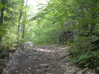
The first mile-or-so is a straight shot on a classic style, wide trail under a canopy of conifers with carpets of moss covering everything.

Looking at Mount
Van Hoe' from the
Swamp.
After the first portion of the trail, we arrived at a pond and got our first clear view of the mountain. Once around the pond, we began our climb.


I thought the mountain started out kind of  steep but became increasingly easier as we moved forward. The conifers gave way to a mostly birch and maple forest. About half the maples had turned to their bright red Fall form, but none of the birches had changed to yellow yet.

The only issue we really faced was the heat and we took a number of quick minute or two breaks to stay hydrated.

Soon we were at the Summit ledges which offered the best view of the inner High Peaks that I've seen this year. I was able to easily identify the mighty Algonquin, the scarred-up Wright Peak, Street, Nye and I could even see Marcy peeking over the mountains in the distance.


Algonquin and some
other High Peaks
.

We could also see the ski jumps and village of Lake Placid to the North, but we would end up getting an even better view of that just a short while later.

Start of the '32 sled
course
.
Continuing on the path past the Summit we left State property and entered the Olympic zone. We followed the dirt and rock remains of the 1932 bobsled course which is now used as a cross country ski trail.


It was neat to see that the sled trail's curves still maintained much of their original shape 85 years later.

Turn One on the
'32 course
.


Start of the 1980
Sled course
.
Eventually, we popped out at the remains of the 1980 Olympic bobsled course with the newer course right in front of us.

Despite having never seen a bobsled race in her life, Kailee thought it was super cool. And, she was right!

We were able to do quite a bit of discovering around the start of the course and ate lunch on the steps of it's lodge which gave us a great view of the village, the ski jumps and Whiteface.


The only bear we've (luckily)
seen this year
.

After lunch I realized the door to the lodge was unlocked and we used it's bathroom and put some our garbage in one of it's trash cans... Amenities we haven't see on any mountains!


McKenzie, Lake Placid
& the ski jumps
.
A tour guide drove a family up the mountain and somehow mistook Kailee and I for a drone crew that was supposed to be there filming.


"Not us, we took the long way up," I replied to him.

"Oh, you're hikers! We get them here sometimes! They're always welcome here and you are too."


We thanked him and began to get our stuff together to prepare for the trek back to the car.

It was a fairly quick trip back to the car and we took some brief stops along the way to enjoy the views a final time.


We both really enjoyed Mount Van Hoe'. Kailee quickly declared that it overtook the #1 spot for her favorite mountain this year. It really is the best of different worlds. On one side you have a sleepy mountain with a historic trail gazing off to the High Peaks. On the other side, a mountain rich in Olympic sports history.

Mount Van Hoevenberg is a must for any hiker looking to enjoy a fun filled day in the Adirondacks. Give it a shot. Trust us. You'll love it!


Mount Van Hoevenberg's trailhead is on South Meadow Drive in North Elba. It's a 2.2 mile walk to the Summit (4.4 mile RT) and approximately 3 miles to the modern bobsled course (appx 6 mile RT.)

If we had an extra adult and car with us we would've walked down the bobsled side and drove back to our car at the trailhead... 

Additionally, one could do this with only one car and walk back to the trailhead via a cross country ski trail for a 9 mile trip. Check out Off an Adventure's review of Mount Van Hoe' for more info on that plan of attack.

Saturday, September 23, 2017

Catamount Mountain 9-17-2017


Camount is a popular local hike and for good reason. At 3,169 feet tall, Catamount is a great mid-size day hiking mountain with stellar views. It also has some intimidating stretches that make for a rewarding climb.


We hit the trail in the early afternoon at a good pace. The first part is relatively flat and borders private property owned by a logging company. It's pretty obvious that the initial part of the trail was once itself a logging road.

Soon, we were at the base of the mountain and we followed it's meandering path upward. It doesn't take long to get decent peeks through the trees. Every time we turned around on this trip we could see the massive Whiteface looming over us.


Whiteface and Esther, among other peaks
viewed from Catamount's Summit.
Catamount has really good isolation and it's proximity to Whiteface gives it what many call "the best view of Esther and Whiteface" in the Adirondacks.


The Chimney.
As we continued to gain more elevation the trail became more challenging. Soon we were at Catamount's chimney: a big crack in the open boulder that we had to use all of our limbs to climb. I got a little spell of vertigo as I reached the top of the chimney. However, Kailee did great and the steep ledge didn't faze her.


Looking back down
At the Chimney.
After climbing the chimney, we were at the nubble - aka the false summit. The real summit was within our sight but it looked pretty far away. However, much of the final leg is on open rock and we made it to the bumpy Summit pretty quickly.


On the nubble. Summit
In the background.
We recognized a number of familiar landmarks from the peak of Catamount including: Taylor Pond, Silver Lake Mountain, Lake Champlain, the Whiteface highway, and the Saranac River. It was also the beginning of leaf peeping season and we were surrounded by a swath of red and green.


The bumpy Summit.
After Kailee had a quick lunch we made our descent. She kept complimenting the condition of the trail, which has obviously been taken care of recently by DEC. Brand new and easy to spot trail markers guided us up and down the mountain. The cairns look like they were freshly installed and parts of the trail even looked like they were just raked.


"I wouldn't be surprised if DEC was here this week working on the trail," I said.


 After getting back to the base of the mountain, Kailee ran the trail all the way back to the car.


A mushroom at Silver
Lake Bog.
We then made a quick side trip to the Silver Lake Bog and checked out it's boardwalk and I demonstrated how quick sand works by sticking a long stick into the bog. The sun was setting and we hopped in the car for the drive home... With a stop at McDonald's along the way!

Catamount is a really fun mountain and I highly recommend it to day hikers looking for some interesting scrambles and challenges! Additionally... If you start early, you might want to consider pairing up climbs of Catamount and Silver Lake Mountain in the same day!

Kailee descending the Chimney.

Catamount Mountain is on Forestdale Road in Wilmington.

Friday, September 15, 2017

Rattlesnake Mountain 9/10/2017

Rattlesnakes on Rattlesnake.

Located in the town of Willsboro and overlooking Lake Champlain, the most intimidating thing about Rattlesnake Mountain is it's name.


Everything about this hill is a treat and it's incredibly easy on the feet.

Alright... I didn't mean to go into poetry-mode there. But, poetic is a fine descriptor for Rattlesnake.

Trailhead. Don't block
the driveway!
This privately owned mountain may be the easiest hike that Kailee and I have done this year. That being said, Rattlesnake is a smaller mountain that should not be overlooked.


The old logging
trail.
One of my favorite hiking blogs Off On Adventure called this hike a gem and I totally agree. The trail
follows an old overgrown logging road with extremely gradual incline over 1.5 miles to the peak. The last short stretch of the path is the only part where it feels like climbing a mountain.


And, that final stretch is really easy as well.

The final "climb."
Considering the minimal effort required for this hike, Rattlesnake pays off in dividends!

We were rewarded with stunning views of RPR, Long Pond, and our last two mountains (Poke-O-Moonshine & Giant) to the South. To the East, we were treated to gorgeous views of Willsboro Bay, the Four Brothers, Lake Champlain, and the Green Mountains of Vermont.


Willsboro Bay, Champlain
& the Greens
.
The pristine weather had drawn a number of hikers to the mountain & we even ran into our apartment's property manager and chatted with her for a bit.


Long Pond, RPR
& Giant.
The true Summit is on a side trail in the woods marked with tape and on this day the Summit rock was marked by a lone paper clip that someone had left on it.


Kailee & I on the
Summit rock
.

Kailee said this was her favorite hike of the Summer because of the astounding views of the lake that she's grown up on. And, I can't blame her for that logic.

If you choose to climb Rattlesnake, please follow the rules posted by it's owners so that others may enjoy this beautiful piece of nature's poetry in the future!


Rattlesnake Mountain is located across from Long Pond Cabins on Route 22 in Willsboro.


Switching poses.


Poke-O-Moonshine.

Wednesday, September 13, 2017

Poke-O-Moonshine - Observer's Trail - 9/4/17


Poke-O-Moonshine is a familiar and imposing sight to many folks in the North Country. Bordered by Route 9 and the Northway, I've driven by the mountain countless times in my life but never put any serious thought into climbing it.

When I first moved to Plattsburgh ten years ago, I became aware of it's reputation as a party mountain with lots of garbage and poorly maintained trails.


Luckily, in recent years the Friends of Poke-O-Moonshine group was founded and took action in restoring the trails and it's fire tower just in time for it's 100th anniversary.

Kailee began asking a bit about Poke-O on our recent descent of Giant Mountain and she thought it was funny that it sounded like "Pokemon Moon."

Nope... That's not a Pokemon...
So it was decided that Poke-O would be our next destination. Although we didn't see any Pokemon on our hike, we did see a bunch of critters and great sights.

I opted for us to take the recently revived Observer's Trail which is a bit longer but is supposedly less strenuous on the legs... Hey, we just climbed a 46er the week before, it made sense to take the less strenuous route!

We set out to learn the trail at Poke-O on a hot Labor Day morning. The heat wound up being the only real issue we faced on the trip. Despite it's length, the Observer's Path is really easy.

It looked to me that the trail was originally graded for horses due to the width of the path and the fact that most of it is just dirt and loose stones.

Along the way up, you pass and cross some beaver ponds which are loaded with frogs and salamanders. We met an older couple and walked and talked with them for a short bit before picking up our pace to the Summit.

We could see some of the maples beginning to change colors as we neared the remains of the old observer's cabin and the graffiti covered lean-to.

Observer's Cabin remains.


The breeze picked up for the last .3 of a mile as we walked along the ledges
near the top and the respite was welcomed by Kailee and I.

As we closed in on the Summit, Kailee became really excited by the appearance of the fire tower.

We summited Poke-O in approximately two hours. We could see Lake Champlain, Willsboro Bay, the Green Mountains, White face, Rocky Peak Ridge and our recently completed friend Giant!


Kailee inspects the lean-to.
We enjoyed lunch in the cool breeze and mingled with the couple that we passed earlier and we ran into Kailee's substitute teacher!

Oddly and unfortunately, there was no tower steward on duty for the busy holiday. So, we were only able to get up to the third level of the fire tower.


On the tower!
Kailee continued to climb up and down the tower three or four more times and even danced her way up one of times.
After an hour at the Summit, we made our descent. It took just under an hour to get to the car.

Poke-O-Moonshine is a cool mountain and I tip my hat to the Friends of Poke-O for all the hard work they've put in there in the recent years.

If you've never climbed this familiar Northway roadside attraction, then I suggest checking it out!

Both Poke-O-Moonshine trails are located on Route 9 in Keeseville/Deerhead. The Observer's Trail is a mile south of the Campground trail.

Not a Pokemon!

Tuesday, September 12, 2017

Giant Mountain 8-28-2017

Hanging at the Summit of Giant!


With Summer winding down, Kailee and I discussed trying a Big Mountain before the school year starts and the cold months that lie ahead.

After some careful consideration, I decided that "Big" mountain would be the twelfth biggest mountain in New York. The 4,627' Giant Mountain (aka The Giant of the Valley) was our destination and it ended up being a terrific peak to climb on the last Monday of August.

Kailee was really excited about this hike as we drove to Giant.

"Gramma isn't sure that we can finish this mountain. But, we will because we finish all of the mountains once we start climbing them." Kailee said confidently as we veered through Malfunction Juntion.

We parked the car across the road from Chapel Pond and signed in at the register and hit the trail... at the slowest pace that either one of us had approached a mountain this year... This was done on purpose. Everything that I had read about Giant said "Slow and steady is the way to go." And, it worked out great for us because Giant throws 3,050' feet of elevation at you over the course of three miles to the Summit. Kailee got a little winded a few times and I didn't get winded once!   ...That's pretty much a personal record.

Washbowl Pond.

Despite the intense elevation gain, The Zander Scott trail going up Giant is awesome . Most of the trail offers great views to the West & North within a half mile of the trek. Also, at a little over a half mile you'll stumble upon Giant's Washbowl Pond. It's a cute pond with amazing scenery surrounding it and it's stocked with trout by DEC. There were a number of campsites being used around the pond that day.

Looking down at Washbowl Pond from the Ridge Trail.
We continued up the rigorous trail and continued to enjoy cool views along the way. We passed a number of families that were coming down with kids that were Kailee's age. Some of them had completed a number of 46ers and proudly listed them off to her.  When asked how many 46er's she had completed, Kailee happily and just as proudly replied "This is gonna be my first one."

Much of the trail was lined with pretty wildflowers and certain parts of the trail took us over cleared massive rock offering more views... and a view of how freaking far the Summit was away from us.

Note: keep your eyes open when you hit these points of cleared rock and follow the nearly impossible to see yellow paint lines on the rock. We ended up straying from them at two different points that led to dead ends.

There's a point in the trail where you can go "Over Bump" or "Around Bump." We went over on the way up and around on the way down. "Over" is cooler. Trust me. Just do "Over."

The Zander Scott Ridge Trail links up with the Roaring Brook Trail for the final 0.7 of a mile... And, it's pretty much the longest 7/10ths of a mile ever. This is no joke. Our slow approach was smart and we were able to move along well for that final stretch. However, the elevation gain goes from intense to insane in that small distance and it takes forever. You can go into this stretch like a raging bull or a sleepy snail... It doesn't matter... You're gonna both end up at the Summit at pretty much the same time... Probably first if you're the snail...

We met a number of nice people at this point of the trail and chatted with them for a few minutes as we all walked upwards. The weather was beautiful and the near-Summit views were marvelous. The breeze rolling in felt great.

We kept hearing it as we closed in on the stretch, "You're almost there."

"Dad, that guy back there said it was only five more minutes to the top. I think it's been more than five minutes..." Kailee said.

"Yeah, because we had to stop, navigate through and talk with those 12 chatty Cathy kids from Kalamazoo Michigan (who were making their way down)," I replied.

Eventually, after a pleasant but long four hour hike, we arrived at the Summit. And it was all worth it. Immediately.

Kailee excitedly kicked off her shoes and walked barefoot on the smooth boulder. I soon followed suit and took off my boots.

We were greeted by Mimi and Steve who had both separately passed us on the final leg. We chatted with them and others as we ate lunch and took in the pristine view from Giant Mountain's Summit.

The Summit offers views to the South, West, and North. I was able to identify Dix, Nippletop... lol... Whiteface, McKenzie and my little friend Scarface... Among others.

Kailee was really excited and goofy as she took in the views, fauna, and ledges.

Giant's Washbowl.
Giant has a cool look to it. As you gaze off into it's washbowl and the Keene Valley, it almost appears if you're the crown on the head of a King sitting on his thrown. Giant's massive arms and hands reach out towards the horizon in striking fashion.

Peeking through the trees to the East, I could see Lake Champlain. I'm not sure if any of the little side trails lead you to a decent view of Champlain... But, I'm sad to say that I assume 100% of them are poop trails... Dude, bury your poop...

We enjoyed an hour or more at the Summit, which is what I was aiming for.

We made our descent and paired up with a Dad and his 10 & 11 year old sons Jake and Luke whom we befriended at the Summit. This was a good idea. We were all the last ones leaving the mountain and safety in numbers isn't a bad thing on arduous hikes.

We had nice conversations on the tricky descent. Kailee & the kids played "I Spy" and pointed out different things within view.

It took us just under 3 hours to get back to the trailhead. We said "Goodbye" to our new friends and I told Kails that "I'm very proud of you."